
Trace a Summit County Street by Address
A Summit County street directory is an address-record chain, not a list of everyone on a road. Property Access locates the parcel-side record. GIS places it among nearby parcels and jurisdiction lines. The Recording Division follows legal documents and title. Historic street sections and Haines criss-cross volumes can then supply a dated occupancy clue. Each record answers a different question, and a deed party, property owner, and historical directory listing can be different people.
- Enter the address into Fiscal Office Property Access and save the parcel number, tax year, and legal description if the card shows them.
- Locate the same address in the Parcel Viewer or Mix & Match GIS to see its relationship to the street segment and municipal boundary.
- Use the current owner and legal description to find the matching transfer in Recorded Documents, rather than relying on a formatted street name alone.
- Move backward through grantees and grantors. Use the web record for the later period, then the Index Book Archive Viewer or the public counter for earlier books.
- For a past year, consult the library street section or Haines criss-cross volume and compare it with maps before treating a listed name as a household clue.
Search a Summit County Street in Property Access
Summit County Property Access has the most detailed published street-search field set. It accepts Parcel, Route, Owner, Address No., Street, and Zip, with Tax Year, sorting, and results controls. The instructions use a number and street name such as 123 main, omitting a directional and suffix in that basic field. Zip is a way to narrow a property query, not a way to generate a list of people.
Owner searches use last name first and the published examples include percent separators. The county also warns that an inexact search can return up to 500 lines. Start specific, use the appropriate tax year, and write down the parcel identifier before moving to the Recorder. The daily-updated public file is a starting point, not proof that every card field is present or that every person associated with the parcel lives there.
| Property Access control | Street-directory use |
|---|---|
| Address No. and Street | Locates a parcel from a known street address. |
| Parcel and Route | Refines a result when an identifier is already known. |
| Owner | Tests a recorded owner name against the property side of the trail. |
| Zip and Tax Year | Narrows geography and keeps the result in the right assessment period. |
Map a Summit County Street Before Naming Anyone
The GIS Parcel Viewer exposes one verified search prompt: “Search Parcel Number, Owner Name, or Street Address.” Its live data did not load during the research inspection, so it is not responsible to promise a particular parcel-card field or an automated neighbor tool. Use the address to position the map, then verify title and ownership through the Fiscal Office record and Recording Division.
The county’s Mix & Match Viewer is a practical fallback. It has Parcel # and Address search choices, a Parcel # and Address results table, and zoom, pan, measure, print, and clear tools. Its Municipalities and Addressing Boundary layers explain why a mailing label, city jurisdiction, and county address administration can differ near a boundary. The county calls its map data informational and does not guarantee completeness or correctness.
Note: Map geometry identifies a parcel’s context; verify legal description, title, and current owner with the Fiscal Office before relying on it.
Summit County Street Records by Address
Several Summit County systems use an address, parcel, or street connection, but they do not contain the same information. Use the property and GIS systems to establish the parcel. Use deeds and plats to test a legal transfer. Use a historical directory for a dated listing. Permits and reports are limited event or project trails. The table separates these roles so a street directory search does not turn a narrow record into a claim about an entire household.
| Record Set | Keeper | What It Shows | Access |
|---|---|---|---|
| Property tax and appraisal | Fiscal Office | Parcel, owner-search, address, ZIP, and tax-year framework | Daily-updated online search; office fallback |
| Parcel and boundary map | Summit County GIS | Parcel geometry, address context, and municipal layers | Parcel Viewer and Mix & Match GIS |
| Recorded deeds and plats | Fiscal Office Recording Division | Parties, transfers, instruments, and legal descriptions | Web 1988 forward; IBAV, counter, or mail earlier |
| Historic street listings | Library Special Collections | Residents or businesses listed at an address in an edition | Digitized volumes and reading-room Haines run |
| Plan-review or police reports | Akron city systems | Bounded project or event evidence | Counter or tailored public-record request |
The parcel number and legal description are the durable bridge. A street name can change formatting or numbering, while a plat and lot description carry the property connection into a deed or map. The normal Ohio voter lookup is name based, not a public street-by-street roster. It can help confirm a known person’s registration, but it cannot supply every name on the road.
Follow a Summit County Deed Chain
The Recording Division preserves deeds, mortgages, easements, plats, releases, land contracts, condominium documents, and other instruments. Begin with the present owner as a grantee around the likely acquisition period. Match the legal description and subdivision or lot, then record grantor, grantee, document type, date, and reception or book/page reference. The seller in a deed gives the next backward title lead, though a mortgage, release, or assignment serves a different legal role.
Browser access and images cover 1988 forward. For 1840–1988, use the Index Book Archive Viewer, the Recording Division’s fourth-floor public computers, or a copy request. Special Collections also has grantor/grantee microfilm for 1840–1914. The Recorder’s public FAQ is the official source for the two-track access system shown here.
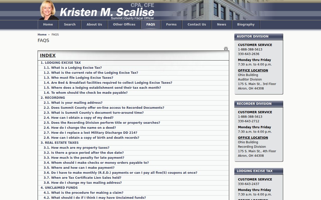
The online and archive-viewer cutoff matters because a house-history search may cross from web documents into older index books without any break in the title chain.
Read a Summit County Address in Old Directories
Akron-Summit County Public Library’s Historic City Directories collection has street sections that list residents and businesses by address. Its later Haines Akron City and Suburban Criss-Cross volumes reverse the task from address to listed name, but the library keeps them in the Special Collections research room rather than promising an online reverse search. Those volumes are a historical street-directory tool, not a statement about current occupants.
Early twentieth-century street numbering changes are the critical local caution. In an 1888–89 directory, street entries can show cross-street sequences, direction, “see” references, alleys, and city-limit notes. Compare those details with a Sanborn sheet, tax map, legal description, or old street section before deciding that an old number and a current number are the same place. For the full historical shelf, use the Summit County city directory collections.
- Parcel
- A county identifier for a piece of land, used to tie the map and tax record together.
- Situs address
- The physical location of a parcel, which can differ from an address used for tax correspondence.
- Plat
- A recorded map that lays out lots, blocks, streets, or subdivisions.
- Criss-cross directory
- An address-first directory that helps find the people or businesses listed at an address in a given edition.
Use Summit County Maps to Hold the Address Steady
The Fiscal Office Scanned Maps collection provides Red Books from 1846–1900 with original-lot and subdivision sketches, an 1870 landownership atlas, Hard Cards from about 1940–1970, and Mylar tax maps from about 1970–1995. These local materials make it possible to connect an old lot or block description to later mapping when a street number no longer reads the same way.
The county began preserving its own records in 1840, and its present Fiscal Office combines functions that elsewhere may be in separate recorder, auditor, and treasurer offices. That arrangement is useful for an address trail: tax, property, map, and recorded-document routes are connected, while Special Collections holds the historical directory and microfilm bridge. A map locates a property context; it does not establish who lived there.
Ask for a Summit County Address Record
When a portal cannot answer a narrow address question, go to the custodian. The Recording Division is at 175 S. Main Street, fourth floor, Akron, and publishes mail-copy instructions. Basic copies are stated as $2 per page and certification as $1. For a city project or plan-review item, the research did not verify an open permit-by-address form, so use the Akron Planning counter or a targeted Ohio Public Records Act request naming the address, approximate date, project type, and record wanted.
Akron’s plan-review portal describes public-record treatment but does not support an invented address-search feature. The captured official page below belongs in a bounded project trail, where it may help date an alteration or identify an applicant of record without becoming a household list.
A tailored request is more reliable than assuming that every building or plan record has a searchable public address field.
Resolve Summit County Address Geography
A street label can cross more than one practical boundary. The county’s northern and southern edges include communities such as Cuyahoga Falls, Hudson, Twinsburg, Richfield, Barberton, Green, Mogadore, and New Franklin that connect to different post offices and, in some cases, ZIP areas that cross county lines. A mailing city or ZIP therefore does not always identify the municipal office that assigns an address, handles a permit, or keeps a local court matter. Use the Municipalities and Addressing Boundary layers before choosing an office by name alone.
The difference also matters when comparing a historic Akron listing with a later parcel record. The historical directory may use an older street label, an “Akron vicinity” description, or a city-limit note. The later tax record may use a revised number, postal city, or legal description. Match cross streets, lot or subdivision, and map context before calling it the same property. When a street number appears to drift, the Red Books, 1870 atlas, Hard Cards, Mylar maps, and Sanborn material give Summit County a documented way to hold the physical place steady.
For a direct address-to-civic-geography result within Akron, the City Council ward finder is another official tool. It identifies a ward from the address, not the residents at that address. That distinction keeps the street directory focused on record custody and parcel evidence rather than personal conclusions.
Limits of a Summit County Street Directory
Address records do not make a complete household register. The property side follows a parcel and a recorded owner. Deed indexes follow parties to legal instruments. Historical directories reflect an edition’s listing practice. Ohio voter tools are built for named-person confirmation and omit protected records. Motor-vehicle and utility customer information are not general public address rolls. Do not infer a person’s absence, status, or household relationship from one missing or partial record.
Lawful use. Summit County street and address records support lawful personal research, family history, estate work, and property questions. Never use public information to stalk, harass, intimidate, or harm another person.